Sunday, November 2, 2008

Photos Finally

Click each photo below to be taken to a Picasa album of the respectave trails:

Pacific Northwest Trail:


Pacific Crest Trail (part of it!!!):


Monday, October 6, 2008

Photo Onslaught

Port Townsend madrona tree:


Sunrise in Pt Townsend:


Memorable ferry sunrise near Vancouver Island:


Typical SE Alaskan views thru the fog:


Sun cooking the fog in Haines:


Haines Junction, Yukon:


Dayhike view just outside of Anchorage:

Mission Complete

After 3 days of hitching, I arrived in Anchorage a day later than I had anticipated, completely happy to be finished with 700 miles of hitchhiking.

Back in Haines, I had planned to wait for 2 friends I'd made on the ferry ride who got off in Juneau for a cup of coffee or something. Instead, I got a bit antsy, and encouraged by the sunny day, I left Haines in the middle of the afternoon headed toward the Canadian border. Even though there were loads of friendly folk in the town of Haines, it took me well over 1.5 hrs to get out of that town. I grew impatient while waiting and started walking toward the 'airport', hoping to maybe find an extra car or two. In the middle of my walking, a man picked me up while listening to some honky tonk in the car. This guy, name naturally forgotten, was working in the middle of nowhere as part of some mining exploration where they'd found Alaskan gold, silver, copper, and bronze. Although he was planning on leaving me 6 miles from the border (easily walkable), he decided to drive me all the way to the border to help me out. Again, an other guy who went out of his way to help me out, a standard on this trip.

And again, border patroll didn't like me. Is it the beard? Is it the fact that I'm walking with a backpack? Do I seem like a total vagrant/bum? After 5 minutes of insane verbal grilling, they let me through, but of course they wouldn't let me stand under the awning in case of rain, and made me walk 1/4 of a mile down the road away from the stopping point. And stop, no one did. I sat on the street, read a bit of my book, and waited while not a single car passed for over an hour. This would become a bit commong while hitching through the Yukon, although technically at the time I was in British Columbia. Finally, 2 girls from Whitehorse, YK, came through and picked me up, even though they had sworn years back that they'd never pick up another hitchhiker. Of course, like a few other drivers, they felt sorry for me since there was no traffic but an abundance of chilly weather.

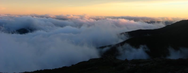
Just after leaving from the border, a bald eagle swooped really close to our car. She even hit the brakes a bit to avoid hitting this eagle, a massive massive bird! I'd seen eagles in the sky before, but it was amazing how ginormous this beast was. It would have done some serious damage to the windshield. Next another enormous bird, a Canadian goose, flew in front of the car. We crossed borders into the Yukon Territory and the scenery turned spectacular. Not to say that the scenery in Southeastern Alaska and the sliver of BC I went through weren't amazing, but the Yukon managed to top them in this section. Loads of rolling hills, all painted by the hand of autumn, unfolded to meet gigantic mountains in the distance. There was nothing to interupt the view of wilderness around except for the road we were driving on. I kept thinking to myself how I would love to come back out here and do some hiking back in the backcountry. At one point we saw a mountain pass that must have been 500 ft deep and shaped like a perfect 'U'. Not the typical small notch in the mountains that I'd grown used to seeing. It was surreal to see, and I couldn't take my eyes off of it since it just didn't seem real.

They dropped me in Haines Junction, YK just before total darkness, and in the middle of falling snow. There was a couple of inches of snow on either side of the street as I wandered around looking for a place to camp. There seem to be nothing but asphalt and no trees to camp in for miles. How this was possible in the Yukon was beyond me, but was a complete eyesore. After looking for the abandonded cabins I'd read about that exist in the town and not finding them, I settled for the heathen option: camping inside of a church. This wasn't just any church. It was a Catholic church that looked like it was made out of an enormous aluminum tube, allowing maybe 30 people inside, complete with a sign on the outside that said 'Come in and rest a while'. Don't mind if I do! It wasn't all that warm inside, but at least it was out of the falling snow and wind.

I woke up early in case anyone wanted to use the church for morning prayer and began hitching. One hour passed, no ride. Soon my toes started to go numb from the sub-freezing temps braved while wearing tennis shoes. I began pacing around to get the blood flowing, something I would have to do constantly for the remainder of the hitching trip. Another 2 and a half hours of pacing passed before I finally got a lift. My dropped me in the middle of absolutely nowhere. Well, there was a closed mining camp behind me where he was headed to clean things out. Cloud cover was a bit too heavy for me to enjoy the snow-capped mountains around me, and I was becoming worried about my chances of getting strated 60 miles from town. 2 minutes later a guy driving a huge truck full of gravel picked me up and said he'd give me a lift 10 miles out of the construction zone up ahead. He offered me a joint which i declined, but also tons of great info on the territory, state of the roads, etc while I soaked up.

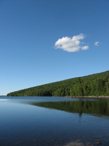
Dropped 10 miles ahead, next to the MASSIVE Kluane Lake, I waited for a while for a ride. With not much traffic on this part of the Alaskan Hwy, my thru-hiker instincts kicked in and I decided to hike it. The lake was absolutely beautiful, the sky primarily blue, and the feeling of untouched wilderness created a desire to walk through it all to view it without a windshield in my way. After walking about 2 miles I roadworker picked me up and said he'd take me to Destruction Bay, the first 'town' in over 100 miles! Well, there were 42 residents in Destruction Bay, one gas station, one motel, and one bar. A bit more traffic though, and a truck that took me another 16 km to Burwash Landing.

Burwash Landing had nothing. My map told me that this town had a gas station, but it had long since closed after tourist season ended. This became a common sight, closed gas stations, museums, and gift shops since not many RV's were out on the road anymore. Burwash Landing is famous for its massive wildfire and it's burned evidence which is still in view to this date. No one was driving through Burwash Landing, causing me 4 hours later to set up camp. Darkness fell and I set up my bivy and quilt under the awning of a closed gold mining museum. I woke up at 4:30 to find my bivy soaked, quilt starting to get wet, and a snow/rain mix being blown under my protective awning and onto me. I reacted quickly to salvage my down sleeping bag, which I knew I needed dry to survive while hitching in these parts. I set up my tent quickly, and crawled inside. My quilt stayed dry, I slept fine, and woke up at 8:00 am, surprised to find it still dark, but at least there were a couple of cars driving by.

Pacing commenced, and an hour later I found myself inside of a truck headed for Alaska. The guy who gaved me a lift was a native american from the coast of Oregon, making the 2700 mile drive up to Fairbanks for a new gold-mining job. He tried to talk me into working for the company, which paid amazingly well since they have trouble keeping people working through -50 temps and midnight sun and/or winter darkness. He got me to the border, and beyond to Tok, Alaska.

Tok was another visual headache, ugly, asphalt everywhere, with low clouds covering any scenic beauty that saved the place. There was however a grocery store, with goods that weren't insanely priced like I saw all in the Yukon. At Destruction Bay a can of Pringles was $4. Luckily I had packed enough food to live off of for 3 days. In Tok, I got some bananas, a cup of coffee, then stood out in the soft rain and snow covered streets to try to get to the next town of Glennallen. There were quite a bit of traffic buzzing past, but I think it was all locals going to their houses a tad past me. I was too lazy and cold to walk another 5 miles to get to the edge of town, so I just stood at the main junction where cars could either go to Glennallen or Fairbanks.

I stood in that place for 8 hrs, met another crazy hitchhiker who was headed to Fairbanks from the eden that is Homer, AK. I watched him get a ride in 30 minutes headed to Fairbanks and started considering going to Fairbanks instead, a 300 mile detour, then going to Anchorage from there. At least Fairbanks would be a larger city (80,000 compared to 1,300 in Tok). Just as I had figured this out during a bout of pacing, a guy saw me while he was standing around smoking a cig. I explained what I was doing, that I wasn't crazy and homeless, and he offered a ride to Fairbanks if I was still on the road at 9:00. I didn't think I would be waiting for another couple of hours, but I did. Ronn rolled by at 9:00, moved his photography equipment around, and I hopped in for the LONG ride to Fairbanks.

Road crews had long since stopped maintaining the icy/snowy road since not many idiots travel that this late hour, providing us with a road that we couldn't travel over 45 mph on. There were a few fishtailing sessions that accmpanied lots of great converstion on both of our excitement of Alaska, photography, and other subjects. We passed the town of North Pole, complete with Santa Claus house, candy striped telephone poles, and business that had to fit into the Christmas theme, even during the summer.

Finally we got to Fairbanks around 3 am, and I had a couch to crash on! Ron welcomed me into his beautiful log cabin, gave me some Alaska magazine issues to read, and we slept and slept. A pot of Starbucks coffee was brewed, cereal eaten, and I was given a lift to the best spot to hitch out of town. For the first time since leaving Haines, things would go my way out on the road. Everyone was suddenly friendly at the gas station I was hitching from, and within 10 minutes a couple picked me up headed for Wasilla, 40 mi from Anchorage, and home of the creepy Sarah Palin. A college couple, Eric and his girl Genene were hilarious and great company for the 6 hr drive. Things were STILL cloudy, a fall/winter/spring Alaskan standard, but great views would occassionally poke through the clouds. We drove through Denali National Park, full of huge mountains, bigger rivers, and massive bridged gorges.

In Wasilla I got a very very quick ride without even trying to the next town, Eagle River, halfway to Anchorage. This guy was full of crazy stories of how tough you need to be to survive in AK. He told me his old lady had a whole checklist of psychological issues, was locked up, had tried to kill him with a knife, and could beat any man in fisticuffs. The dude giving me a ride claimed he even burned down another mans house when he discovered the guy had stolen his car. Weird stories, but at least he got me closer to my destination.

Fall colors painted the mountains and I could finally see the ocean. In Eagle River I got another ride without even trying by a guy going all the way into downtown. He knew exactly where the address was where I was headed, gave me advice on the best chai tea and breakfast in town, and left me right at Truants doorstep.

Finally gave Truant a hug when I caught up to her, and also Sweetfish who hiked with us was in Alaska, another hug. It was so so so so good to finally get into Anchorage, see a couple of good friends. 5 minutes after getting reaquainted, we headed to a party with Truants cowokers. Not only did I need to the company of friends again, but I needed pizza, and more importantly, beer. I got all of these things at the party. Relaxed party, a little bit of good beer and a little bit of fantastic pizza. A great ending to a great trip.

I had been seriously considering a cycling trip to get from Colorado to ATL after leaving AK, but now I don't think I'm going to do that. I'll probably just stay in Alaska longer than expected, seeing all that is within a 5 mile radius now that I have access to a car, and return to ATL in time for my sisters wedding. So, I managed to complete all of my dreams that I had before starting this adventure at the end of April: make it to Canada, make it to the Pacific, and make the ferry ride up to Haines. Becoming great friends with Truant added a 700 mi hitch to Anchorage into the mix, and all of that is now done. The cycling trip can happen in the years to come.

Thanks for reading my blog. This is probably the last entry, other than the possible addition of photos if I can get any uploaded. Bye!

Monday, September 29, 2008

Into the fjords

Well, finally I have achieved another recent dream of mine: making it to Alaska via the state ferry system.

After 5 different bus connections in WA, I found myself at the Bellingham ferry terminal and shelling out $358 to take the ferry through the fjords of British Columbia and Southeastern Alaska to wind up in Haines. As soon as I boarded, set up my gear on the heated upper deck, and met everyone up there, I knew it was going to be a memorable experience. There were 25-30 yr old fisherman returning to Kethican to start a new fishin season, expecting to round up a few grand per week, then take a few months off of work and living on that cash. A few other people were just traveling through Alaska like myself. Tom, a Brit, is heading up to Anchorage to train dogs for mushing. Kim is just taking the ferry to Skagway, and returning on the ferry, without stepping into Skagway, just to spend a week out on these mystical waters. Within an hour we were into great conversation and the ferry was leaving the dock in Bellingham.

Vancouver Island on the Port side of the boat emitted lights at night that drowned out stars that we should have seen. When I awoke, there was what may have been the best sunrise I've seen on this entire trip. Next to the boat's wake, i couldn't believe that there were Dall Porpoises leaping through the sun-tinted red water. 30 minutes later after the sun finally reared its head over the mountains to the East, an enormous pod of at least 30 dolphins was swimming right next to the ferry. They were close enough that I could even hear them making their high pitched sounds. Very very cool. A few hours later there was an announcement on the PA telling us that whales were spotted at the front of the boat. Sure enough, we saw 2 whales, and throughout the day saw a few more. The wildlife out here is dense.

Bethany and Tom wound up turning into really good friends, and we spent time together walking into the first port town, Ketchican. The weather was typical Southeast Alaska fare: cold, cloudy, windy, rainy. We made it toward Creek Street, which was a fantastic boardwalk perched upon pilings to keep the 'street' out of the creek below. There were business and a boardwalk for pedestrians all elevated above a large creek. In the creek we couldn't believe that we saw hundreds, no THOUSANDS of salmon. The air reeked of death, and we later found out that many fish were now dying since they finished their runs for spawning. There were a few fish floating on the top of the water, hundreds and hundreds below swimming, and soon a seal came into view and snagged a fish! We'd see this seal later in the day swimming around the creek, not seeking fish, but seemingly having a good time. What a scene! After wandering around the 'street' checking out toursity shops and native art, we walked the boardwalk over some rapids in the creek. There were salmon flying through the air, trying to fight their way upstream, but we didn't see any of the make it.

I glanced at my watch and realized that we only had 40 minutes to get back to the ferry before it left again, and the ferry was 2.5 miles away. We walked casually, then had to run the last mile to make it back just in the knick of time. The further we headed north from this point, the thicker the fog would become, and the less we could see.

Nearly all of the rest of yesterday was spent inside of the ferry. Conversations. Book reading. Naps. Nothing exciting. Today, it was a bit sad to tell Bethany and Tom goodbye when they got off the boat in Juneau. 2 hours later the scenery got fantastic. I happened to spot a waterfall coming out downhill from a glacier so I stepped out into the intense wind and rain to check it out. Hidden in a calm doorway, I was amazed that finally we have entered the signs of autumn in Alaska. Half of the hillsides were covered in yellow trees, growing on what appeared to be sheer cliffs that dropped into the ocean. No beach. Finally this was the Coast Range of alaska, and these mountains were huge and impressive. Lots of snow on peaks. More glaciers. More waterfalls. And many more photographs taken.

I stepped off the boat finally in Haines, got a quick lift from a local who claimed the security onboard had torn his van apart, and was surprised that the town is even smaller than I expected. Great setting and I can't wait to explore it even more.

Tuesday, September 23, 2008

Details of a Dead Whale

I'm going to try to do more justice to the end of my journey now.

Leaving Forks I had to do a 9 milish roadwalk to get out to the scam that was and is Oil City. I got a lift from an Indian man out of town and began walking on the busiest section of active logging that I've seen yet. At least 50 dumptrucks and logging trucks flew by me as I walked along, but it didn't bother me since I knew the ocean was drawing closer with each step. When I was nearly to the end of this roadwalk, I was blown away with an unexpected advantage of all of these trucks flying by: odd natural sepia tones. The road was primarily dirt and gravel, and when the trucks flew by creating clouds of dust of this material, it would settle on the surrounding foliage. This made for fantastic photography as I tried to get the odd brown look of all of the plants that should have been green, and oftentimes a bright yellow flower would be transposed over top to give a truly surreal appearance to the scene.

Finally I got to the ocean. I've already written about what an experience seeing the ocean was for the first time. What I forgot to include was how odd the sound of the ocean was. The sea was at low tide, which I was unaware of at the time, and emmited a constant low rumble. I couldn't really make out the sound of each individual wave, but instead there was just the steady sound of brown noise that the sea churned out. Very odd when coupled with the monotone visuals of the area and unreal amount of driftwood brought out by the river. Later I found out that this area gets psychotic storms in December, oftentimes with winds over 100 mph! That knocks down absurd amnts of old trees, evidenced by the washouts I saw in many valleys, the rivers bring them out to sea, and the sea brings them back to the beach. It was also fun to hear about how much the beach changes each year near the river areas as the sand is always shifting. This environment is truly alive.

The first 3 days were very fun while getting used to the seastacks out at sea. Sometimes the walking would be on sand freshly packed by a retreated high-tide, the other times would be on very very slippery rocks that covered the beach. A few days into the trip, I had to do a 3 mile roadwalk into the town of La Push to pick up care packages that a few friend sent to me. On the way into town I met two guys finishing a cycling trip from Seattle to La Push, and it was really inspiring to see them doing it 'outlaw style' with mountain bikes and huge army backpacks, obviously doing it on a shoestring budget. They were also having a great time.

Although I had planned to try to offer someone $20 at the marina for a ride across the unfordable river, I instead took the .75 bus and then a 5 mile roadwalk to get to the coast on the other side. This is when high tide was in full form and I saw how massive the waves could get out here, which isn't something I had seen before. I was actually a bit scared by how large the waves were, and could finally understand how surfers were able to surf out here on these dangerous seas littered with underwater seastacks. The tide was high enough to force me onto driftwood to stay out of the water. After doing this painfully slow hiking on driftwood, balancing above a few creeks draining into the sea, I decided to hike on the ocean side of the driftwood. This meant hiking when the waves would receed into the ocean, hopping up onto a log as a waved crashed in to stay dry, and repeat. This took me to a large cliff where water was lapping right up to the side of the cliff, a few feet deep. I could have waited and stared at the seastacks, rare blue sky, and waves, or I could try to dash around the cliff when the water was right. Naturally I chose the latter. It was fun getting around that headland without slipping on the descent from the partial climb of the cliff, and not getting soaked by the waves. A trip highlight for sure.

Next I got to a headland that was impossible to get around until the tide dropped another 2 feet, an hour later. I waited with 4 guys from Seattle and 3 others from Vancouver. Fun times. Finally the water was shallow enough to wade through a foot of water around the cliff and made it to camp with an hour of daylight. Keep in mind that i was hiking 10 to 12 mile days, so things were relaxed nearly all day.

The next 2 days were all cloudy, with not much social interaction. The next to last day I camped in the woods since pitching a tarp was very very tricky in the loose sand. I drank my 22 oz budweiser, slept under a slight drizzle, and hiked my last day to the little island. There was the dead whale on the island and the sea lions at sea as I described before. A couple of deer stalking campsites for food, and my photo taken by two guys returning from Shi Shi Beach.

Yesterday I spent the day primarily bouncing from bus to bus to get a package shipped from my parents of normal clothing to wear on the AK ferry, in AK, and any future travels before returning to ATL. I met a woman who just finished a cycling trip on the peninsula, again more inspiration for a cycling trip! Sleeping in the bunker was surprisingly warm last night, and I know that I've found a great spot to sleep in for the next 3 nights. It was a really nice 40 minute walk during surnise through sleepy P.T. streets to grab some coffee at the record store slash espresso joint and pick up a couple of used books to read while I'm here. I'm really starting to feel at home in this small town.

Monday, September 22, 2008

Land's End

Well, yesterday around noon I finally finished my hiking. It put a cap on about 5 days of spectacular hiking along the Washington coast. All of those days were grey except for one full of blue skies. That day was also probably the most fun since there were 2 headland sections that saw me waiting for waves to recede before rushing around the cliff, all instead of waiting for high tide to go back.

I'm a bit lazy right now to do a proper write-up, but it's easy to say that the coast was more amazing than I had expected. The moment I walked out onto the beach at Oil City, I was completely mesmerized by the odd black and white of the coast. The sky was blanketed with white clouds, the ocean had no real color since the sky had none, and there was nothing but thousands of driftwood logs around as well as seagulls bathing in the water where river met sea. That first hour was completely perplexing, but soon the feeling faded (sadly) and I got used to the way that the WA coast is. I met well over 20 incredible people. Camped with quite a few. Had a great stew with a group of retired guys from Orcas Island who had caught Black Bass, Mussels, and seaweed (not a tough catch) that morning and treated me to some. So delish. Other highlights were having a cup of chai tea with a couple from Seattle, and having a conversation with a Russian woman about their situation with Georgia and the way the US media is misrepresenting what is going on over there.

Somehow I managed to get not a drop of rain in my 10 days of Olympic National Park hiking. I got to what I assumed was Cape Alava, which really is just a stretch of beach with no definable characterististics other than maps show it as the furthest point west on land in the lower 48. At lowtide, turns out there is an island that the locals call 'cannonball island' that has an exposed sandbar which allows you to hike further west on it. I hiked out onto this island, but not before nearly tripping over a beached sea lion! What a massive creature, and its laziness somehow made me sad. Out on that island, I had the place to myself, took some pictures, and ate a celebratory apple since my celebratory beer had been drank the night before. Of course it was cloudy and I could hear waves crashing, but there was also the cacophony of hundreds of sea lions moaning out on another island a mile or so out to sea.

Walked 3 miles back inland, and within an hour had a lift back to Port Townsend with a fascinating man who actually has a house in the park on the beach, hidden behind trees, that he refused to sell to the govt when they tried to take all of this land to build the coastal addition to the park. Great conversation with a cool man to end the trip.

Last night I actually took a real shower, did real laundry, and slept on a real bed, all things I hadn't done since Skykomish. Even had a towel! Tonight and the next few nights I plan on sleeping in the WWII bunkers in a state park just outside of town. It's right next to the beach, so I can wake up and stare at the waves as I munch on a bagel. Come Friday at 6:00 pm, I'll be loading onto a ferry headed for Haines, which is some 3 days away at sea. Getting excited.

Tuesday, September 16, 2008

Autumn in the Olympics

For the first time in my life I considered the following: Maybe I should turn back, there are more important things than hiking straight to the ocean like family, friends, and future adventures. Here I was, doing the most intense bushwack of my life up what was surely the steepest slope I've hiked along in my life, with no trail other than what I assumed was ROUGH mountain goat trail to follow.

Everything was going so well before this. I had even begun to think about how I couldn't believe that I was going to make it. All trail would be ahead of me, no nonsense logging roads or 'scratch trails' made by the PNT. The ranger on the phone talked me into a reroute through the Buckhorn Wilderness by roadwalking an unplanned 15 miles down to the town of Quilcene. I had to hike FAST...had 3.5 hrs to hike 14 miles. I didn't think I'd make it, but I made it with time to spare, and felt like I could easily justify my pizza, fries, and strawberry shake. I hiked east a bit and entered the fantastic Buckhorn Wilderness. I followed the Quilcene river upstream until I hit Marmot Pass. Quite a few others had the same idea, and at the top one girl gave me her yogurt pretzls after we exchanged stories. Hers was of travels in South America and how I needed to go, and I told her stories of hiking from Mexico to Canada and now here.

One thing I did not anticipate about this hike is that I would see the seasons changing again. I got to experience beautiful cacti flowering in SoCal, and now at the top of the passes east of the Olympic rainshadow, I was seeing ginormous patches of red and oranges in meadows. I'd hike right next to this low-lying red brush, and when seen across a valley, the sides of each mountain were splashed with red and orange and yellow. Beautiful.

The eastern side of the Olympics were quite dry, which I'm discovering is how I tend to prefer my mountains these days. Very rocky above treeline. Not much undergrowth when actually under trees. The next pass, Constance, was even better. This pass I had entirely to myself to nap on. The view was even better than Marmot Pass, with deep deep valleys below me, and of courses more flourishes of autumn color. The descent was a different story. I had to drop 4,000 feet in about 4 miles. This was definitely the steepest trail I've hiked since the descent to Ross Lake. I ran at least half of it since it was such a pain to hike such a steep slope. That night after getting to the bottom at the Dosewallips River, I camped at a beautiful spot at Lillian Camp.

The next day was the day of Appleton Pass. Things began innocently enough with a gorgeous rainforest walk through the Elwah River Valley. Then I started the approach to Appleton. I was warned by two guys going downhill that there was some avalanche damage, and to look for the trail uphill. Finally I got to the avalanche area, which consisted of TONS of flattened trees all over the mountain. People had mashed down tree branches and such from this mess to walk upon, forming somewhat of a trail. I got to the 'cairn' the guys told me about, and saw this 'path' heading uphill, to the left as they said. So I followed. For the first 1/4 of a mile, I had to scootch along a log, rested a foot on a snow bridge (in september!) that broke under my foot, and then that trail disappeared. There were a few tiny trails in all directions where I assumed that people had branched their own way. I decided to make my own way as well. I had to pull myself up using the bottom of trees uphill, constantly scrambling and climbing with my hands, utilizing them as often as my foot. I slid a couple of times downhill 10 feet or so before managing to stop the fall by latching onto a root or tree. If I would have slid further, it would have resulted in me toppling over a 15 foot cliff that was carved out by the creek I was paralleling. At this point I though maybe I should turn around, but just couldn't make myself do it, especially since I was only a mile or so away. I kept following the creek uphill which the crappy map seemed to indicate the trail did. Finally after over an hour spent climbing 1 mile, I reached a meadow area, no trail. I wandered all around for at least an hour above treeline hoping to cross the trail. Never did. I decided to give up for the night, and go back downhill for the night.

After sleeping in the middle of what I was told was bear country (scat EVERYWHERE) and in the middle of a mountain goat trail, I was awoken by the trotting of mountain goats. I made sure to make lots of noise so they wouldn't trample me since I was hidden by tall grass. After a scary descent back down that same steep drainage area, I found a trail! It was down at the bottom by the cairn, but in a totally different direction from where I came. I probably would have discovered this a bit earlier, but I lost my map 1/4 way up the climb when it got caught in a tree unbeknownst to me. I was so so so so so so so happy to find that trail, and not give up the section or do some goofy reroute via roads.

I climbed the Pass, walked the High Divide...beautiful valleys everywhere. View of the massive glacier on Mt Olympus. Great convo and view on Bogachiel Peak of the ocean with a couple from Seattle. Then walked thru idyllic Hoh Rainforest, complete with some of the biggest trees I've seen on the hike, and lots of really impressive nursing trees.

18 roadwalking miles later, I got to the intensely hot Hwy 101. 15 minutes later I was inside an SUV getting a ride from Jessica, an 07 PCT thruhiker. Next year she plans to kayak the Yukon River all the way to the Arctic Ocean with her boyfriend! As soon as I got to town I gorged on tacos like she told me, got a great pizza and ice cream, then stealthed in a spot on the south side of town. Since I didn't pay for lodging in this town, that makes me successful at not paying for lodging since South Lake Tahoe, about 2,000 miles ago! Sweetness.

I'm about to head out of town for about 11 miles of roadwalking along Oil City Rd to get out to the ocean where I'll camp next to the mouth of an unfordable river. This will set me up nicely for a headland that can only be rounded at a 2 ft tide, perfect for the morning. Next update I should be finished, hopefully celebrating in that town I loved so much, Port Townsend. Then the blog will turn into v2: the ferry and hitch to Anchorage.

Wednesday, September 10, 2008

The Sea & The Rhythm

Not much time to update with the evil public internet countdown telling me I have 7 minutes remaining in my session. so..

Roadwalked out of Anacortes sans Shinsplint...definitely a good day already. I climbed Mt Erie, which didn't have the great view that the guidebook suggested. Oh well. Lots of roadwalking until I got to the beautiful Deception Pass State Park at the head of a new island...Whidbey Island. Did a bit of beach walking which was very relaxing with waves on this island! More roadwalking took me near an Air Force Base which was the most annoying part of the hike yet. Planes were CONSTANTLY circling overhead, and LOUD. I came very close to taking the FREE! bus into town into a library or coffeeshop just to get a break from the madness. I was actually at a bus stop looking at a map to see, but decided to keep walking.

About 2 hrs before nightfall, I was out of range of that damn base, and finally back on the beach. Joseph Whidbey S.P. didn't allow camping, but I found a sweet spot regardless. Great sleeping next to the waves.

Today saw me do half beach walking, quarter high up on bluffs, and a quarter on roads. The bluffs were quite beautiful, and the highlight of the past few days was walking on the side of one of these bluffs around a Lagoon. Great great views of the glistening ocean below...200 ft or so below. Caught the ferry just in the knick of time, and found some surprise care packages at the PO...good times.

Port Townsend is a fantastic town I can tell. Great old buildings, cool town layout, and more beautiful women than I can recall seeing in a trail town in MONTHS. The weather is gorgeous out as well: blue skies and 70 degrees. Tomorrow I'll knock out 15 miles or so on road, and thats about all the road walking I'll do (crossing fingers) until getting to the Hoh Rainforest.

Till Forks....

Monday, September 8, 2008

A day of rest

Well, I decided to take a zero day today.

Last night turned into an interesting night since I wound up selecting a stealth camping spot near a bum hangout! It was really just one homeless man, a guy who claimed to have been educated in nuclear engineering. I may be gullible, but he surely seemed to have the proper jargon. Anyway, he told me I had chosen a good spot because the police had kicked him out of the fancy shmancy park in town a few days ago, but directed him to the spot that we were sharing. He also managed to tell me many cool details about the area that made me happy to have met him. Sure there was some mumbling, sure he asked me for change this morning at McDonalds because he didn't recognize me, yes he offered me some Port, Champagne, and Whiskey, and yes, he even confessed that he had a warrant out for his arrest for Petty Theft in the next county over. I still slept in the same spot, just made sure I slept with my camera inside my bivy with me! Good times in Anacortes!

Shin split still acting up today, but getting better. The upside to staying in town for another day to heal is that I discovered one of my favorite bands, Earth, is playing in Anacortes on the 20th. I went to the record store to investigate, and it turns out that the venue they are playing is an old Department of Safety building that was converted into an art space and all ages venue. The dude at the record store told me to go check out the art studio, so I knocked on the door and they let me in. Some cool photography and sound installation by an artist from Australia.

Tonight I will not sleep by the homeless chap who has also been to the Maritime provinces of Canada, but instead I've scoped a sweeter spot near some yachts by the bay. Probably won't bother updating in 2 days in the town of Port Townsend since I'll just leave early the next day to make up for my time off here. I'm hoping to get to Forks in about a week, get online there to appease all of my hungry fans, then make it to La Push a few days later for a possible hitch/bus/ferry back to this island for that Earth concert if it all times out right. It'll be time for another day off by then anyway. Then will come the final push up the coast, which I"m way excited about. The other day on the horrendous roadwalk, a cyclist came over, offered me a peach, and told me his favorite spot in WA is Ozette, which is right next to Cape Alava, which is a Cape I'll pass just before finishing. He waxed poetic about the petroglyphs on the rocks. I"m even more excited than I was before that maybe I'll wax poetic about them as well once I finish.

Until that waxing....

Sunday, September 7, 2008

Saltwater at last!

Yesterday was a beautiful day. A day that finally saw me dipping my hands into salty salty water to wash my face in the blinding sun. Man it's bright down here out of the woods. Let me retrace my steps:

The roadwalk out of Glacier was pretty nice. Let me go back a bit more: I never actually stayed the night in Bellingham. Lucas and his sis decided to go to Orcas Island to hit up the skatepark, which left me without a place to crash. Way too many homeless folk in Bellingham, way too much traffic...all contributing to my desire to go back to quiet, home-ish Glacier. Those guys gave me a ride to the bus stop where the determined I could get back to within 15 miles of Glacier for only $.75. Well, on any day but Labor Day. That left me hitching back...which took about 5 short rides, an IPA, and a Hawaiian Pizza with salmon on it later.

9 Miles hiking on the shoulder of scenic HWY 542 went by pretty quickly with no traffic on a Tue afternoon, and massive massive glacier-robed Baker Mtn on my side. I made it to the swampy Swift Creek trail just as darkness was descending, and camped next to my first blaze on the PNT. The Swift Creek trail was an easy trail to follow, completely unlike the rangers told me it would be. Had a fun time getting back to the trail in TOTALLY overgrown woods on the otherside of the Swift Creek ford. MOre following of colored ribbons...some of which lead to nowhere, some of which lead me to a new trail.

Next up was the logging road section. This had turned out to be much more beautiful, and much more difficult than I had imagined. Envision this: I started hiking the 542, went over the shoulder of Baker Mtn, down a few thousand in elevation, and then into Logging Land that took me along the nothern ridges of the Skagit Valley. This valley is BEAUTIFULLY rich farming valley that trends east-west, my ridge was the northern one. I followed logging roads (losing them often) while heading west and toward the ocean, all the while this valley was to the south of me. Somewhere near Goat Mtn, I saw the saltwater for the first time to the west. What a phenomenal sight. Finally the rain had stopped a day or so ago. There were no clouds. The weather was the best I'd had in a week. And there was the ocean. Having a concrete destination that I could see made me really start hiking hard to get out to the sea. Problem is....my 7 yr old maps dont have all of the forks of these roads on them. Lots of the logging roads aren't numbered or signed. Lots of frustration resulting from walking down the wrong road. Lots of elation from using a map and compass correctly and giving me such a good feeling.

Next day saw me going over Anderson Mtn on more logging roads. The view from the top gave me the best sunset of the trail, something that has become a trend as I'm looking west all the time, and there are always marine clouds in the sky these days. The sea was getting closer and closer. On the west side of Anderson Mountain, I began seeing white blazes on trees for the first time. This made it so I didn't have to look at my map every 5 minutes to verify where I was. It's nice, but also lazy...but a nice change of pace.

I made it to the tiny tiny town of Alger...is it national news that this town had a random shooting of 5-6 people on the street? There was a candlelight vigil going on as I walked into down at dusk. The bar delivered a fantastic burger and some great beer....exactly what I had been dreaming of for the past 3 days. Exactly what had kept me going through some of the harder times on those damn loggging roads. When I was leaving, an awesome guy named River walked up and asked if I needed a place to crash. Of course I did. He led me back to his table where I met his 2 other friends, then we went back to their place. They lived at an old rock quarry .5 miles out of town. Totally off the grid. They have solar panels hooked up..and they lived out of individual tour busses, a van, and I got MY OWN YURT~!~!!! to sleep in. Great guys...fed me good oatmeal with fresh, locally made applesauce the next morning before taking off.

Yesterday I finally made it down to Samish Bay after a fantastic overlook, complete with Para-sailers taking off from it of Vancouver Island, the Olympic Mountains, the San Juan Islands, and lots of deep blue ocean. Gorgeous. There was pavement to be pounded, and pound it I did. Down here near Samish and Padilla Bays there are many many farms. It's been superb hiking in such flat land. Not because it's easy, but because there is such a contrast in this minimalistic ground/sky relationship that I"m not used to in the dynamic folds up high in the mountains. Some goats followed me. Dogs keep barking at me. Lots of stares toward the funny man in the skirt by passers-by in their cars.

Today the roadwalking finally got to me and I"m developing a shin splint and an achilles problem. I plan a short day tomorrow after picking up mail at the PO to set up a total beach walk the next day at low tide along the legendary Strait of Juan de Fuca...which I"m very excited about. Lots of hundred foot high bluffs that can't be hiked in front of during high tide. More bald eagles I"m sure. Anacortes is a decent town, but it's no Glacier. Maybe I'll post some pics tomorrow...I'd really like to, before heading out of town, climbing Mt Eerie, then sleeping on the coast. Tonight I"ll try to stealth downtown in the beautiful public park.

Monday, September 1, 2008

Precip

Alpine country is constantly hidden in the fog. The clouds condense onto the vegetation on the mountains. This vegetation is always draped over the trail. I'm always walking through these plants. My legs get soaked, which then drip into my shoes. My feet are soaked. This is the tune that keeps playing that I'm growing used to in the Pacific Northwest.

Although the past week or so haven't been very rewarding in terms of views when I'm up high, when I'm down low under the canopy of trees, the constant moisture has proven to be absolutely beautiful. Trees growing on dead nursing trees. Moss on everything. Ferns everywhere. Massive trees. Green slugs.

END OF THE PCT

Leaving Skykomish toward the end of the thunderstorm was a good thing. Just out of town, we all got wet and cold though, and hiked a really really fast 29 miles so we could hide in our tents from the moisture inside our warm down bags. The next day turned into a really rewarding one, a day that started with snow! On the climb up, it started to snow, and this gave everything up high a really pretty look that the marmots were whistling to. Views opened up, and I was surprised at how unique the mountains were. They looked similar to southern california, but very very high up. Large mountains, bigger valleys, and fun hiking under clouds that were starting to break up.

We hiked a bit faster than planned, and wound up in a bus headed into the town of Stehekin just as the rain was coming down. This town turned into one of the best towns I've ever seen. No roads enter this town other than a 10 mile dead end road that runs from the mountains to the town. Huge mountains dump into a beautiful lake that the town is based around. The bakery had some fantastic day-old pastries for 2.25. Naturally I took advantage of the free intown camping as well as the showers for $.50 to offset my FANTASTIC $17 italian dinner.

Once we left Stehekin the weather got bad again, and never really improved. A group of 7 of us made it past the trail magic of beer to camp together at Rainy Pass. The next day we all got split up. A 30 mile day had us camping at Hart's Pass, and the next morning we stumbled upon a yurt in the mist. We had heard rumors of a yurt that we could use, but couldn't believe it when we found this yurt down in the valley full of fog. Truant, Sweetfish, and I were all soaking wet and cold, and the yurt was a dream come true. It was complete with mountaineering magazines, futons, beds, and even a pair of kitchen gloves for Sweetfish to keep his hands dry. We stayed for an hour, and then finally forced ourselves back into the fog.

That final day on the PCT we all had fun together knowing that it would be the final day we would be hiking with each other. We took a long break sitting on a huge log at Holman Pass where I would turn west the next day. I figured the border was about 20 minutes away when I rounded a turn and suddenly saw a huge gap in the forest, the border. There is a huge line of missing trees which defines the border between the US and Canadia. The ending of this trail was the complete opposite of the AT, where we had been staring at Katahdin for days, and then were looking at the peak for miles as we were climbing up. I was so shocked to be done with the PCT that I'm still stunned. That night the 3 of us had a great time camping .2 miles into Canada while our other friends went down 7 miles ahead of us into the resort because they were wet and cold.

HEADED WEST

The next morning was sad leaving Truant and Sweetfish, but once I got moving I was inspired to be alone. Still, I spent the entire day thinking back to good memories of the PCT and missing their company. Of course the views were still in the fog and I was soaked, but around 1:00, the sun started to break through and I could see into some distant valleys in the Pasaytan
Wilderness.

I took a long break at Holman Pass, the point 17 mi south of the border where I would be leaving the PCT for the PNT. Once I turned onto the PNT I was stunned to find a ziploc with a piece of paper labeled 'Eric J Payne'. Once I opened it, I found an encouraging note and a pack of M&Ms from my friend Lost. A great surprise that really put me into a good mood to start the climb up to Sky Pilot Pass. Immediately I could tell that the trail was tougher than the PCT. This hasn't changed much to this day.

I'd say that the PNT reminds me of the climbs of the AT, except with switchbacks to show exactly how steep the mtns really are, the moisture and undergrowth of the Eagle Creek Trail, and the views and valleys of the Glacier Peak Wilderness. A lot of the junctions aren't labeled, keeping me on my toes with map and digital compass. There have been some really fun stream crossings on fallen logs. Following blue ribbons in the trees. Not many people out there.

I made it into the town of Glacier last night after an IMMEDIATE pick up when hitching in a VW van with a dude listening to Rage Against the Machine. There was a spot on top of moss begging for me to set up my tarp on it hidden behind the Forest Service office. The italian joint supplied me with handmade spinach ravioli in a creamy walnut sauce and the general store hooked up a 6.99 22 oz of Stone Bitter Chocolate Oatmeal Stout which I enjoyed while writing in my journal sitting on a picnic bench near my camp. This morning I got a few baked books from the 'Wake n Bakery' with some great organic coffee. Boredom took over and I decided to hitch into the next town over, Maple Falls, which promised not much more than a gas station/coffee shop with hopefully a better newspaper selection than the Bellingham Gazette. I got picked up by a couple who offered me a place to stay in Bellingham, a city I had planned on visiting. Now I've got internet and relaxation before taking a $.75 bus to Kendall, which will put me 15 miles west of Glacier to pick up my mail drop tomorrow when the PO FINALLY opens at 2:15. whew.

Huge glaciers. Waterfalls on par with the High Sierra. Green, green, green. Fog. And now Ive got a mediocre camera to capture it all, and maybe I'll keep uploading photos for all of my 'fans'. Haha. Next update will probably be in Anacortes where I'll take a half day off.

Wednesday, August 20, 2008

Weak

It's official: I'm a wimp. The rain was just pouring this morning, so I decided to take another zero and relax under a free roof. Besides, I don't think I'll have this opportunity again for the rest of the trip along the Pacific Northwest Trail, so I should make the best of it. Plus, the fact that all of my friends were staying, friends who I perhaps won't ever see again, made me want to stay even more.

Gear notes:

I've done some gear swapping to prepare for the onslaught of WA rain that should creep in at some point.

-Umbrella: I'm really excited to have my umbrealla back for the rains out on Olympic National Park.
-Rain Jacket: No more windshirt which was ok in a drizzle, but invited hypothermia when worn alone. After an insanely creepy storm on Sonora Pass in California, I realized that my poncho-tarp wasn't really any good on exposed, windy ridges. Now I've got a cheapo 5 oz cyclist jacket made by O2 that the legendary Disco swears by. I've already noticed that it's horrible at cutting the winds we experience when hanging out by the river here, but I'll have to deal now.
-Warmer quilt: The 45 degree quilt that EVERYONE made fun of out here finally had to be swapped out for the 20 degree Nunatak one which I love fondly. Since I got the warm quilt, I made the sketchy decision to get rid of my insulated Montbell jacket and smartwool bottoms. We'll see if I can stay warm enough at night with this setup in an attempt to shave some packweight that was gained by adding the umbrella.

We're all getting a ride back to the trail tomorrow at 6 am since the rain should be stopping sometime tomorrow afternoon. In a day or so, we enter what is said to be one of the 3 most scenic parts of the trail: the Glacier Peak Wilderness. This area has been rocked hard by floods and landlides in the past few years, and promises to have some tricky navigation as well as lots of blowdowns to contend with. At this point, we're all up for the challenge and not too intimidated by it.

Can't wait to make the next post at beautiful Glacier, WA.

Tuesday, August 19, 2008

Real Weather

Notice: I finally got around to erasing that god-aweful header of 'Enlightened Ultra-Adventurer' off of this page. It was an inside joke that made 4 of us laugh in Bend, but no one outside of our silly circle. There was a nice mix of Andrew Skurka and Backpacker insults hidden within.

Welcome to WA

Entering WA was a bit depressing. There were lots of clouds. No views. Lots of climbing. Disco and I were in some sort of funk, and he blamed the cloudy grayness....giving us Seasonal Affective Disorder like people get who live up here. I don't buy it, but I had no energy for those first 2 days out. We have started to find lots of wild fruite out here: huckleberries and strawberries. Fantastic and those boosted our mood.

It took a while for WA to grow on us, but it really blew our minds in the Goat Rocks Wilderness. The views grew massive, the wildflowers were out in full force, and we got our first dose of threatening weather for a while. We were up on a ridgewalk which Disco described as being similar to the interior of Glacier NP....deep, deep valleys with waterfalls everywhere. During this ridgewalk, clouds starting rolling in. Not happy cumulous...but dark, grey, and tall cumulonimbus. We were a bit nervous about the weather, me especially since my rain system was minimal at best: a wind-shirt and poncho-tarp. Luckily we made it down from the ridge, views unobscured by low-lying clouds, and camped for the night.

After 6 days without a town stop, we stopped into the 'town' of Steven's Pass...really just a gas station and ski resort. After a fantastic sandwich, it was off into mosquito territory. I left Disco and POD behind after another fantastic day being dazzled by so many wildflowers. Sad sad times since they were some of my best friends out here, and I don't think I'll ever see them again. I camped beside a tarn with a great view, to setup for my longest day yet: 70 miles of hiking. 70 MILES.

Hiking 70

To successfully hike 70 miles, I decided I needed to make use of every second of daylight. It was tough to sleep due to nervous anticipation, and I was out of camp at 4:55 am. I got to see the sun rise above the wilderness valley and I was off with great speed. There were a few large climbs up to passes providing spectacular views. There were downhills from these climbs where I was moving at 4.5 mph. Lots of hills were around to slow me down. At the 24 mile point, around noon, I was exhausted, and the day was barely 1/3 of the way done. I took a 30 minute break and felt completely refreshed. After about 40 miles, at 4:00, I met up with friend Gopher. He let me lead because he knew what I was doing, but he kept up with me for a good 30 minutes, giving me some conversation that I needed on the long day. After darkness came, and I hit the 50 mile mark, things started to get blurry. I had a decent amount of energy, but after mile 56, I had to take the caffeine pill and ibuprofin that POD had given to me. This gave me the boost I needed at took me to mile 65. At mile 65 or so, I started to run out of energy and begin yawning. Sitting for a 5 minute snack break, I decided to try to make the 70 miles within 24 hrs. This required a constant 3mph pace...usually doable without a problem, but 22 hrs into the hike, became a bit tough. Sadly, the terrain became much much harder than I've seen since the High Sierra. My tired muscles could barely handle the downhills, which felt way way steeper than I know they were. At points I had to jog down them because I felt like it was too difficult to control my muscles enough to hike normally. There were tons of rocks on the trail like the AT, causing me to wince at every painful step onto them, and jumping from rock to rock...avoiding mud...walking on icy snow. With 15 minutes to go, I didn't t hink I'd really make it. I started to walk as fast as I possibly could....very hard to do at this point. With 7 minutes to spare, I made it to the road...70 miles later. I found a space to sleep behind the ski lift, and drifted off.

After the 70 mile day, I had some long, tiring days until I caught up on sleep. The hiking was spectacular through the Alpine Lakes Wilderness. The last day before town, a storm rolled in, showering us with sprinkles all day long. I was hiking alone for that 31 mile day into town, and loved finally seeing clouds and watching the fog drift in to the mountains. It's very moody out here, and when the sun finally breaks through it feels like it has meaning...none of those boring blue skies like California always had.

No more updates until I'm westbound on the PNT I think.

Thursday, August 7, 2008

Bridge of the Gods

These past couple of weeks have been some of the best of my hike, due to two reasons: the Three Sisters Wilderness and the Eagle Creek Trail.

After firing a Glock 9mm and an AK-47 at the firing range in the high desert outside of Bend, we found our way back onto the trail on a beautiful day. The weather was superb, and the mosquitos were no more. The southern half of the Three Sisters Wilderness was full of typical forest far, but the northern half was so much more. Soon we were hiking out on the Wickiup Plain...huge open space full of rolling hills with the large peak of South Sister looming above. South Sister was probably the oddest mtn I'd seen at that point...the rock making up the mtn was a pretty and deep red color, and the glaciers up on the mtn and from the past had put odd scars into the sides. Instead of having a sharp peak like most other Cascade peaks seem to have, this was much more rounded. Hiking throuhg that plain was extremely fun, and each of the other sisters (Middle and North) were fun, but not that fun. Each of the sisters was it's own unique entity though, with glaciers doing a different number on each of them.

Once we got near Mt Jefferson, there was more snow than we've seen in months. There was quite a bit of fantastic ridgewalking, with creepy clouds rolling in. The clouds were dark, but didnt' look like they were towering enough to throw lightning at us. We got to the top of the ridge, and then a huge snowfield appeared. This field of snow wasn't too tough to navigate through, we've been hiking long enough to spot where a trail SHOULD be seen through the trees due to how far the trees are spaced apart, or maybe just through plain intuition. After coming down from this, we hit a wide open meadow that still had multiple of feet everywhere. I came down by myself and started to wander around looking for the trail, and soon San Gabriel, Forrest, POD, and Disco showed up to help. We wandered around for nearly 2 hrs, unable to find the trail. The problem wasn't just the snow, it was the fact that a pretty dense fog had crept in making it impossible to tell where the ridges were around us, and certainly impossible to see the 3 lakes we should have been able to use to navigate from which were below us somewhere. About 20 minutes before dark we decided to wait until morning, when hopefully the fog would burn off once the sun rose. That night the clouds finally broke giving us rain. The next morning there was still fog, but Forrest magically found the trail not that far below where we had camped.

Sometime after noon, the clouds all broke, and the day turned beautiful. There was quite a bit of dry ground, until we hit Jefferson Park. Again...bit open field....lots of snow, but no fog this time. We found our way to the ridge north of us...and climbed up to another snow-filled north slope. Descending from this turned into the high point of the day....we all just RAN and slid, and boot-skied down the mtn in record time.

With the snow behind us, it was time to fly toward Mt Hood on dry land. For some insane reason I started hiking the next day at a CONSTANT 4 mph pace...and did a 51 mile day to have a fantastic all you can eat breakfast at the swanky Timberline Lodge. Such good food.

Now I'm getting forced off the library computer at Cascade Locks...tomorrow I cross the Bridge of Gods that spans the Columbia River, and start a 3000 ft climb up into the state of Washington, where I will spend the next month and a half.

Monday, July 28, 2008

Drawing Blood

BEND, Oregon

As psyched as I was to be in Oregon for the first couple of days, that energy has waned a bit in the last few days. That's not to say that this section of southern Oregon is fantastic, it's to say that I'm not here at the ideal time. This year was a record snow year, and there is still snow around, even approaching August! This means that when it melts, there are puddles abound. These puddles are breeding grounds of mosquitos. Mosquitos love human blood. I"m a human, and I hate mosquitos. Recipe for torture. The past 3 days have probably shown me the worst swarms of these creatures that I've seen in my life. They don't just come out at night, it's an all day onslaught. It sucks stopping to take a break and they find a way to bite you on that 1/2" of exposed skin between pants and sock. They sneak under your headnet when you swear that there was nowhere they could get in. Then you are forced to take off the headnet to get the bastard out of there, when more mosquitos start buzzing around your face, which would get trapped inside when you replace the headnet. My solution?: just squash the little guys against my face, trapping them between skin and netting. I have daydreams of getting a good picture of myself with mosquitos and blood splattered on my face due to this practice, but the guys I'm hiking with have yet to tell me that I've got tons of mosquitos everywhere on my face. Hopefully sometime to show these 'war wounds'.

I hiked about 3 consective days of 40+ miles, leaving Sweetfish and Truant behind in pursuit of burning off this excessive energy I've had built up for a while. I'm not sure how much longer I could have kept pushing myself on those big days, and on the 4th day, a planned 50 miler, I was happy to meet back up with good good friends Disco and Princess of Darkness as they were packing up in their tent. The previous night I had camped under the north side of Mt Thielsen, by far the coolest mtn I've seen on the trip, after a bit of nighthiking of course. Those guys were so excited to see me, and I to see them. We hadn't seen each other in over 2 months, not since a week or so before entering the High Sierra. We've been hiking the past 3 days together since that day.

These guys are absolutely hilarious, and it has been fantastic hiking with them again. They got me to slow down, down to 25-30 mile days. We take breaks, despite the heinous bug situation, cracking jokes the whole time.

Even though the mosquitos have been trying to ruin this section of trail, it has been strikingly beautiful. The woods here are pretty lush and green, the greenest I've seen since hiking the AT. Lots of trees are covered with moss, at least down to where the snow line occurs. They get this weird, old, Dr Seuss appearance to them that I really enjoy. There are lakes and ponds EVERYWHERE. This is also making the mosquitos, but i"m sure in August this would be an amazing place to camp, in constantly wonderful weather. Speaking of weather, it has been flawless, every day is 70, but just not quite enough breeze to keep the mosquitoes at bay.

Now I'm in Bend, at Jess and Traeja's house...friends of POD and Disco from the C.D.T. Great great guys, in a really cool city, with a car to drive around the city. We are taking 2 zero days here, going to a shooting range later to shoot a gun for the first time in my life, and then to the Deschutes Brewery for some brew and good dining. This is going to be a good town stop for sure. I'm in BEND! and these guys have a hammock that has a view of the Three Sisters Wilderness, capped in glaciers...right in the backyard. Life doesn't get much better. Can't wait to get back on the trail, to hike around these huge snow-capped mtns and the sinister lava flows that exist in the area. Next stop is Cascade Locks and the Columbia River at the WA border for sure.

Sunday, July 20, 2008

Pushing Boundaries

A New State

The short 37 mile stretch between the Seiad Valley and the Oregon border turned out to be much more enjoyable than I even could have expected. After waiting for the post office to open, and downing a single 1 lb pancake (not 5 like the infamous 'Pancake Challenge' dictates), I took off, alone, up a long 4500 ft vertical climb out of the valley just before the intense heat set in. The hiking felt absolutely fantastic after having spent the equivalent of 2 days off, one in Etna, and the other hitching around the fire, and more importantly, having a new pair of shoes. Finally I have some cushion under my feet and every rock stepped on doesn't cause me to wince in agony. Once at the top of that 4500 ft climb, the trail meandered along a ridge, giving really nice views of smoky ridges that stretched as far as the eye could see, reminding me of views I've gotten back east of the fantastic 'smoky' Blue Ridge Mountains.

I was pushing pretty hard to try to catch Truant and Sweetfish, who had left the night previous, to cross into Oregon in good company. I would later find out that I managed to pass them at lunch time when they were hiding in some shade barely off the trail. Apparently I'm a stealthy hiker, not a loud one. I'd say that's a good trait.

What Limit?

37 miles after I had started hiking that day, I found myself at the Oregon border, with no more than 10 minutes of daylight to spare. Earlier in the day I had told myself that if I didn't catch my friends before the border, then I'd just keep hiking by myself until I finally reached a goal I'd been dreaming of for months: the elusive 50 mile day. Thing is, I had always been planning the 50 mile day under more ideal circumstances. A bit further north in Oregon where the trail is supposedly dead flat, after starting at dawn for optimal daylight amts, and not after a 4500 ft climb to start the morning. No matter, I was feeling inspired and had to get that goal out of the way.

The moon was full, allowing me to use my headlamp only half of the time I was hiking, which was essential given the fact that the batteries would wind up dying on me JUST before getting to my chosen camp. The valleys below were spectacular when bathed in moonlight, and each saddle that I'd come upon bridging the gap between mountains would prove to be more and more fun to walk through than the previous one. I was taking nearly constant breaks after the 40 mile mark to help satisfy my nonstop hunger, but didn't mind since the moonlight gave the night such a cool character. Somewhere in there I decided to push even further than 50 miles, and instead to do 55 so that I could finish at one of the few shelters on the trail, and take at least a majority of the following day off to let my body recover.

2 miles before the shelter I was completely shocked to find my first bit of trail magic in the longest time. There were two coolers hidden under a tree, one with caffeinated beverages, the other with Miller High Life. I desperately needed the Mountain Dew since I was starting to continually yawn and feel exausted, and packed out a beer for celebration the following day. Not only had Oregon supplied me with superb nighthiking and a great mood since stepping foot into her, but she also provided this. Then it became easy to hike those remaining 2-3 miles, finishing my 55 mile day at 4:45 am.

Relaxation

I never really got a chance to sleep that morning since other hikers left and chatted with me, and other day hikers showed up to picnic, hike, or bird-watch in the area. Who needs sleep after a 55 mile day anyway? Nearly every local who came up to me had an interest in my hike, and nearly everyone offered some form of generosity. Again: I LOVE OREGON!. Cliff bars, oranges, soda, and even a place to stay were all offered to me. The shelter was a massive open air structure in a beautiful valley overlooking a sweet view of Mt Ashland. There was water downhill a tiny bit from the shelter, and there was no need to take a northbound step that day.

Toward the end of the day Sweetfish and Truant showed up seperately: Sweetfish pushing on to get into town that night, and Truant to wind up staying and treat me with great conversation deep into the night over a fire, and then lying in sleeping bags realizing we had all the time in the world to chat, and no need to rush to sleep.

Civilization

Since we only had 11 miles to hike into town, we took our sweet sweet time rolling out of the sleeping bags and into a chilly Oregon morning. An awesome Australian couple gave us a lift into town, and even offered us money to buy a beer at one of the local brewpubs. We have been craving Indian food for weeks, and Ashland like nearly every college town, had 2 Indian restaurants, both even had lunch buffets. It was lunchtime, and we needed a buffet to satisfy our appetites, but both joints were oddly closed on the weekend. Instead we followed the advice of Aussie Malcolm and went to a cool little Mexican joint downtown, Agave.

Following Sweetfish's lead, we picked up packages at the PO and then went back to a free spot to stay in town that he had secured days and days ago back at Burney Falls Park in NorCal. It was a huge studio that belonged to a woman who does scene design and other fun stuff in this funky, arty town of Ashland. She showed up hours later and gave us a lift to Safeway to get supplies for a BBQ that we were invited to that night. At this BBQ, I had tons of great conversation about the Oregon and city of Ashland that all of these people loved, and naturally fielded questions about what life on the trail was like. One guy told me about Mt Thielson, which I need to research to find out if the trail goes near it. Apparently it is an old volcano, and consists entirely of the sweetness that is Obsidian. If you climb to the top, you can see where it is constatnly being struck by lightening and shaped into these odd jagged columns inside. I must see this mtn if we go near it.

Getting Cultured

While at this party, we found out that Connie, the woman we are staying with, could get us free tickets into Ashland's legendary Shakespeare festival. Normally tickets cost over $100/pop, but she scored us 3 seats, second row on the balcony. I hadn't been to a play since the end-days of college, and it wound up being a great experience. After it was all over, we all chatted with Connie until she took off in her SUV for the California coast and a 4 day kayak adventure/vacation. Now we have the day to ourselves, her space becoming our space. A space that will be abused for planning and organizing all food and gear needed for the rest of Oregon. The rest of Oregon will be 2 weeks of resupplying at resorts just off the trail, but no trips into real towns that sell food. All supplies must be shipped to the resorts to be picked up, so there isn't much margin for error in estimating the amt of necessary grub. I'm starting to think that if I'm making good time (everyone says Oregon is easy, but no one can comment on the rumored snow that could slow us down), I may take a long hitch down into the city of Bend, which I've been interested in visiting for a couple of years now. Quite a long hitch, but would a nice reward if I can afford the time.

I probably won't be able to update this blog for nearly a month since there probably aren't computers for us to use at all of these resorts. Crater Lake and Timberline Lodge near Mt Hood should be spectacular, with gourmet buffets I hear, but no online connection till perhaps Cascade Locks, a TOWN! just at the WA Border. Till. then....

Tuesday, July 15, 2008

Rome still burns

Recently my mindset has shifted a bit: I want nothing more than to get the hell out of California. Sure we keep hearing stories of snow around Crater Lake, and the 'impassable' passes in Washington, but at least I would be out of fire country. I'm here in the sleepy, quaint town of Etna, CA, just south of a new trail closure through the Marble Mountain Wilderness. The name of this wilderness area alone should be enough to make you realize how spectacular the are would be.

I digress....the days preceeding my current frustration have been fascinating. I went to 3towns (the tri-city challenge) within 24 hours for a pizza buffet and outfitter in Mt Shasta City, the bus to Shasta in Dunsmuir, and then a replacement trekking pole waiting for me at the PO in Castella. About 8 miles out of Castella, I enterened the Trinity Alps Wilderness. The past week had been a torturous fight against nature, through poison-oak overgrown trail, opressive heat, and thick thick humidity (remember I'm from the south..I know humidity)...so it was nice to get high in elevation, over 7,000 ft, into breezes, thinner air, and wide wide views. The Trinity Alps have a very unique appearance, and are different than the 2 mtn ranges that follow it. The rocks are Ultramafic rocks according to the guidebook, and they all tend to change to a rust color over time. Not red rocks like in Sedona, AZ, but still fun to look at. There were long ridges where you could walk for miles without a tree obscuring your view of the lakes and valleys below.

Next up was the Russian Wilderness. These mtns were all granite, much like the High Sierra country. No snow though. Around this time, the smoke really started to roll in and I could even see across the narrow canyon to the mountains on the other side. The cliffs to the east were spectacular, but it was dissappointing to not be able to perceive the great views that surely existed if it weren't for the thick smoke. About 7 miles later I was to a road.

This road marks as far north as I can hike on the PCT, since there is fire across the trail and firemen in the area trying to put it out. I waited with Roadrunner for over 45 minutes for a hitch on a road that saw only 4 cars driving by in that amt of time. Luckily a really nice guy picked us up on his way to Yreka from work, he swore he would be the last person driving on that road before dark, and it was still over an hour until darkness would descend. We got left off at the CCTG (Cali Campus Training Group), who house hikers for free. They let us take showers (it's been over a week I think, if you don't count my "bath" in a creek 5 days ago), laundry, and use their kitchen for a luxurious meal of mac-n-cheese. Keep in mind that I ditched my stove and pot back before the high-sierra, now all of my meals are soaked and cold. Try to imagine how much I enjoy hot meals now. And hot showers. But can't say the same for 'cold water'. The water is ice-cold when straight from a spring, and definitely lacks that nasty city chlorine flavor.

Now I'm taking the day off to rest my ailing feet that got really eaten alive over the past 3 30+ mile days, being housed in shoes that have walked over 1,000 miles. Luckily my shoes were waiting for me at the post office here. Hopefully I will be able to hitch to Yreka (native american word for Mt Shasta)then to Seiad Valley tomorrow once Sweetfish and Truant show up in town. This will make me skip nearly 60 miles of trail, putting me less than 30 miles from the CA/OR border. Finally, out of California and the wildfires (pretend you can't hear that Mt Adams is burning in WA for the moment.) Until Ashland....

Saturday, July 5, 2008

Missed Miles

It's official, I've cheated. These 1,200+ fires have finally gotten to the PCT, and a 100 mile section of trail was closed from around Quincy to Belden to Chester. We got to a road, there was a sign telling us that the trail was closed (which we already knew), and we had to find a way around it all. The road that this left us stranded at was a really quiet road, making us feel desperate about our chances for getting a hitch out. No hitch, then it would be a 30 mile road walk to get to Quincy. Luckily, a woman was going camping down the road, and gave us a lift to town. After doing some research in town, I discovered that there was a bus, that for $3, would drive us all the way to Chester. While we were waiting at the bus stop, temptation came toward us in the form of free tickets to the High Sierra Music Festival that was happening this weekend at Quincy. For only 8 hrs of work helping wave traffic into a parking lot, we could have had 4 days of hippie, jam-band music bliss. I was tempted by the option of relaxing for the weekend listening to tons of music, but turned off even moreso by knowing that this would mean my ears would have to tolerate hours and hours and hours and hours of endless musical noodling.

The bus ride itself was a fun adventure. A couple of locals took an interest in those of us filthy from days on the dusty Norcal trail (10 hikers on the bus), and gave us all sorts of info on the towns we were passing, the lakes with views obscured by smoke, and places to legally (sort of) camp once we got to Quincy. In Quincy, the first object on the agenda was to find dinner. Quickly. Dinner was found at the Kopper Kettle, a mediocre restaurant that served me with the first turkey that I've had on the trail. Darkness had settled in by the time we finished, so we wandered around down to the park that the toothless woman on the bus had told us about. Sure enough, there was camping to be had behind a fence to a baseball field. First I needed more food, and bought 2 pints of ice cream from the gas station. Once that Mint Brownie and Chocolate Maltball dessert was inside of me, I crashed for the night.

3 hours later at 1:00 am, I heard someone shouting 'No! No!'. This was Justin. Then I heard Sheik Olivier yelping. These guys had unknowingly camped next to a set of sprinklers that decided to turn on in the middle of the night. The past 3 days have found us chuckling endlessly over the mental image of guys scrambling around in their boxers, trying to gather their clothing, then prancing across the field in sleepy slumber to avoid the blasts of the sprinkler. Somehow I had chosen a spot that stayed dry throughout the night.

After trying over an hour to get a hitch out of that one-horse town, Sweetfish, Truant, and I decided we needed a break in the form of breakfast number two. The owner of a hardware store directed us to a diner down the street, and his advice was good indeed. I had an absolutely killer Chile Verde omellette that gave me the spiciness I so desperately needed to get going that morning. Once we stepped out the door and were across the street, we were picked up within minutes by the owner of a different diner. We didn't mention that we had just eaten a fantastic breakfast with the competition.

The mix of a full stomach and bloodstream full of caffeine had me flying across the flat trail. It was a strange feeling to be transported to trail 100 miles further north of where we were just hiking less than 24 hrs before. The landscape was different. Flatter. More trees. Less views. But oh so nice to be hiking with soft pine needles and soil underfoot. Our goal was an easy 18 miles that day to Drakesbad Ranch. By 5 we were at Drakesbad, where they treat thru-hikers like kings. As soon as we walked up, we were handed towels, a change of clothes, and asked to hand over our dirty clothing (that would be ALL of our clothing) to a woman who would wash our clothing for us. Then we hopped into the pool heated by the local hot springs. Then we were fed an amazing dinner centered around Duck, and topped off by all we could eat ice cream, raspberry sorbet, and some sort of fancy pastry thingy. Naturally we hopped in the hot springs one last time until it closed before going to bad. Unfortunately there wasn't enough time in the day to hit the horseshoe pit.

Next morning we were treated as royalty again and were allowed to abuse the breakfast buffet for the price that children pay ($5!!!). The hike out was a bit more this time. I needed to do 24 miles to get to a trail angel's place in Old Station. I decided to see more of the park that we were in that the PCT fails to show us. We were hiking through Lassen Volcanic National Park, but the trail kept us stuck in trees the whole time, rarely showing us the volcanoes, and geothermal action that the park is known for. I found a map, then made my own route up taking advantage of side trails to see these things. I split for 4 friends who stuck to the PCT, and was treated to odd land, covered with gray and black sand/gravel. 3 miles west on the PCT it was all soil and pine straw, but over here, everything was different. It was like a desert nearly, punctuated with the occasional tree poking out of the dark gravel. The further I hiked, the weirder things got. Soon there were orange and pink cliffs to my right. Soon Cinder Cone came into view, a nice rounded old volcano. Once I started to climb this Cone, I could see the legendary Painted Dunes. This was the highlight of the past 2 weeks or so. The climb up was brutal, every step sand a few inches into the sand, and it was a slow, steep climb up to the top of this cone. Up top, there was a huge bowl, and even some yellow flowers managing to grow in what seemed to be nothing but gravel. When I turned around to return, I really noticed how amazing those colored dunes were below me. The top of each of these little foothills was dotted with a splash of red, then around that splash was a dab of pink, then a bit of orange, and that faded into a soft brown. It really didn't look real somehow, and especially when in contrast to the 'Fantastic LavaBeds' beside them, which was just lots of huge black rock strewn about, nothing more.

The 10 miles into town were incredibly easy, so easy that I was inspired to do some trail running to pass the time. By 7 I found myself at the General store calling the local trail angels to come pick me up. At their house, dinner was waiting, surrounded by 6 of my friends. There was chili, there was spaghetti, there was salad, and then there were homemade brownies and rootbeer ice cream, made the way I used to make it at Grandma's house, cranked by hand. I was fed well the next morning as well, tons of french toast and eggs. Then I spent an hour lying in a hammock, and not hiking today. What a great experience and a great place to spend time. And it's all run on donations at someone's home. Tomorrow I hike out onto the Hat Creek Rim. An infamous HOT HOT spot and a 30 mile dry stretch.

Sunday, June 29, 2008

Lost Weight

What's the longest you've gone without looking in the mirror? A day? Two? I hadn't really looked into the mirror for weeks until last night upon getting into Truckee. Sure I've glanced to make sure my hair looked ok, or to see how ridiculous my beard looks. This time I realized how much weight I've lost and how skinny I've become. This caused me to proceed to step on a scale and find out that I've lost at least 15 lbs, and that was with a full stomach after dinner. Thing about it is, I feel better than I've felt in a long time. Not much muscle on upper body, not a shred of fat, but feel superb everyday.

To correct this possibly weight problem, I'm taking a zero day here at a trail angel's house in Truckee. After taking a shower as soon as I got here, there was a huge dinner waiting for us. There are 6 hikers here, and we had a feast of SALMON!!!, Ribs, steak, chicken, stir-fry, Corn on the Cob, and Potato Chips. Wow. Today I'm taking the day off for an egg/pancake/coffee breakfast, TONS of little debbie junk foods, bagels with cream cheese, fruit salad, and another amazing dinner I'm sure. CALORIES is the name of the game before I get out and possibly hike all 40 miles into the next town of Sierra City in one day.

Relaxation

A day off in Truckee staying at a sweet cabin on Lake Donner means recreation and relaxation. There are boats, canoes, and kayaks here that we are free to use. I'm hoping to score a bike and ride into Truckee, but not sure if the guy here only has fancy road bikes, which I don't want to be responsible for ruining. At the very least, I plan on getting in a kayak, paddling to the park on the opposite shore, and loafing for hours. Oh yea, there will definitely be some swimming thrown in there too.

The miles, the smoke

I have been flying the past few days due to many reasons. Well, not really flying, but the 25+ mi days have felt really fast because I haven't been allowing myself many breaks. Reason being there is smoke everywhere destroying the views, and there are mosquitoes everywhere there isn't wind making sitting still a lesson in patience.

The views? Well, when not clouded in smoke, they have been of some funky, metamorphic/volcanic (where is geologist Steve Taylor when you need him?) rocks, unlike any I've ever seen before. Lots of really cool, craggy spires...covered in green lichen, and crumble under the touch. Luckily most of the excessive water hundreds of miles south is gone, but not the mosquitoes. Still, I'm not crossing over 20 streams each day via logs/rocks, wading thru waist deep water, or dancing around too many muddy bogs. It's really really really nice to be hiking on dry land again. Really nice.

Wednesday, June 25, 2008

Finally online again

Amazing that I was able to go a month without signing onto the internet. I"m not sure that this has happened since back in grade school, but I'm proud.

So so so so much has happened since then, obviously.

Catastrophe

First the melodrama: my camera fell into a creek. Not just any creek, but a crik 6 days into the High Sierra. My memory card was in there. I have no pictures of the High Sierra at all. And the High Sierra is by far the most beautiful area I have ever been to. Screw the Grand Canyon, the wilderness of Maine, the balds of North Carolina. That hurts, but what can I do? Practice nonattachment.

Onward

Anways, I saw more desert since we last spoke. I went through the typically horrendous stretch of Mojave Desert where people see temps soar over 100 degrees, while walking over the concrete LA Aqueduct, but I was underclouds with a terrifying thunderstorm threatening. The storm never came, but the clouds never failed to amaze us. We took an absurd amount of photographs of these clouds, naturally I can't post any of them since I'm not technologically advanced enough, nor do I have the necessary connections (the real reason).

I got to the High Sierra....carried 10 days of food to go 10 days without seeing a road. Saw no other people out there in the wilderness except for other thru-hiking friends, with the exception of tons of people hiking up Mt Whitney. Yes, I can now brag that I've climbed the tallest mountain in the lower 48. It's a pretty hard climb too, especially when you haven't climbed over 10,000 feet in the past 4 years. I was out of breath constantly, but the views were spectacular, the snow fun to climb over, and the ice creepy to slide around on.

The Infamous Passes

On day 4 or so, we entered the world of infamous passes. I was hiking with friends Sarong and Wasa (dunno real names really, but from Philly and Santa Cruz, respectavily), and we approaches Forrester Pass. I've been reading for months how terrifying the Passes were, and now it was great to see what they were actually like. Once I got 2 miles before the 'V' in the ridge that was Forrester Pass, the trail completely dissapeared under the snow. Out the maps came. Out the ice axe came. It was like hiking in Antarctica out there. Really fun to make up my own route according to the map, and just go cross country to get there. Once I climbed up the steep mountian wall to get to the pass, I could see a staggering view of the alpine lakes on the other side. Going down the mountain from the pass is equally as fun as climbing since I just sat on my butt, and slid down the thing. MUCH MUCH faster than going up.

After about 5 days of hiking in persistant snow, I got sick of snow. There are suncups. I hate hiking on sloped suncups, sliding all over the place. Scraped up shins and legs from postholing in the snow. Snow is water in disguise, and when it melts, it covers the trail downhill in a giant stream. There is water everywhere making it really tricky to decide what is the trail, what is a stream, and what is both. But, it's all so worth it for the views of the mountains in snow. Yes, I want my cake and I want to eat it too.

Beer

After 10 days away from civilization, I went a few miles off trail to Vermillion Valley Resort. Here I picked up some food that Ma shipped me, and took a day and a half off to relax my body. Beer was drank. Tomalie Pie was eaten. Jokes were made. Beer was drank.

Dry?

After going north from VVR, north through Tuolomne Meadows, it may be safe to say that the trail is drying out a bit. There is still surpsingly snow at elevations as low as 8,000 ft. There are no more waist-deep creek fords though, from what I can tell. Now there are actually conveniently placed rocks to hop across instead of making crazy leaps across crazy things to find away across a water source.

However, there was a storm the other day. A storm creepy enough to have me consider going back down the mountain to safer elevations. There was hail. There were the strongest winds I've felt yet out here. Incredibly exposed, but apparently I lived. We got to the top of the pass and thought that the worst of the clouds were passing us. When we wrapped around the mountain 2 miles later, we saw more coming from a different direction. Well, we nearly sprinted, with numb hands and feet, down to the road. I hadn't planned on going into town, but the town of Bridgeport, 30 miles away, offered a dry motel room, food, beer, and most importantly....ice cream. Sweetfish and I got a ride into town by a Mom and her curious daughter. We both had pizza and a burger. I had a teriyaki burger. Later ate an entire cake and pint of Haagan Daaz ice cream. Showered for the first time in 2 weeks or so. Cleaned up some terribly torn up and infected legs and feet. Now I feel much better.

And I hitch hiked alone from Tuolomne Meadows down to Yosemite Valley. The valley was phenomenal itself, but the place is a zoo and a shopping mall. Sadly I'm still holding a grudge for the fact that there was an Ansel Adams 'Gallery'. Not a gallery at all, but really just a store selling his prints in disguise. Ansel would have been disgusted.

I'll be getting online more frequently now....

Thursday, May 15, 2008

Sand and Sand

When I chew on my couscous dinners at night, sand crunches between my teeth. My camera lens grinds when I shut it because of sand. If I take my earbuds out of my ears after listening to music, they are covered in sand. Sand is everywhere.

The high desert is an amazingly varied place. I have come to the realization that every canyon has it's own character. Yesterday after leaving Cajon Pass, hiking through the San Andreas Rift Region then through the freakish Mormon Rocks, I saw the greenest canyon I've seen yet. I didn't think much water ran through the area, but there were actually trees on the side of this low elevation canyon. After climbing about 1000 feet, and snaking around to the other side of the mountain, it was all sparse chapperal. Fun. I climbed uphill for hours, finally reached a jeep road and cooked dinner over my woodstove. The plan was to hike another mile or so to find a nice soft spot with pine needles for cushion since I'm using a really thin sleeping pad, but plans never stick with me. I got inspired out of nowhere and decided to nighthike all the way to the road crossing where I"d hitch into this town, Wrightwood. That was 12 miles, a fullish moon at Waxing Gibbous, and no need for a headlamp to see ahead of me. The hiking was slightly sketchy, nearly losing the trail at a few road crossings and at a strange ski resort, finally making it to the road to sleep at 1 am. I slept on the side of the road, which receives no traffic at night. I woke up 5 hrs later to an awesome sunrise over Mt Balden-Powell, which still has lots and lots of snow. I'll be climbing up this tomorrow, hopefully to the peak to get a view of Death Valley, miles and miles away. Now it's time to find one of the local trail angels who take in hikers, for a MUCH needed laundry session. Rinsing in lakes and streams just doesn't cut it for a white shirt in the socal desert.

Monday, May 5, 2008

Road-walkin' the PCT

What a rough stretch of days. I managed to get sick somehow in Warner Springs, sidelining me for another day. I decided to take off the next day with only a few slices of bread in my stomach over the past 24 hrs. Bad mistake, as any reader could predict. Even though I was feeling better than I was in the past 2 days, I wasn't ready for hiking. I was tired, dehydrated, etc etc. I didn't enjoy the first 17 mile day until I got to the spot I would be camping.

The spot I was camping was trail angel Mike's place. Mike is a local who lets you walk .25 mi down a dirt road, take water from his spigot when he's not even there, and even has a screened in patio that thru-hikers can sleep in. I got here and found 4 other hikers there. Greybeard, Ross (Naugty Eyes), Gopher (who I met last year on the AT), and others I barely noticed in my sickened state. We all sat around goofing around, and I was able to somehow eat a cup of Ramen noodles, which Mike left behind for hikers to eat. See, I've been having a problem eating any of my trail food. It was either too sweet or too bland.

Next day was a bit worse, but I managed to pound out 10 miles by lunch time. After sharing some shade with Ryan, Gopher, and Greybeard, I pushed on in the 90+ deg heat, desperately trying to make it to the Paradise Cafe, 14 miles further! I made it 7 more miles to a water cache, and had to fold it in there. I wasn't able to force any food down the stomach, was having terrible stomach cramps, and decided the smart decision would be to chill for the rest of the day. It was around 3:00, an early time to stop hiking.

I spent the rest of the afternoon talking to Lucky about his state of Michegan, Hawaii, and our hikes of the A.T. I gathered a bit of fuel for fire, which is plentiful here in socal with dead chapperal branches everywhere. I tried to enjoy some spaghetti, then called it a night, without even writing in my journal, which is rare.

The next day I awoke, feeling healthy and ready to hike. Still, I knew I had only 10 miles to hike so I stayed in bed a bit and waited for the sun to heat up the 36 degree air. In the meantime I listened to my mp3 player that I received in Warner Springs. Sweet bliss. When I got moving, hiking had never felt so good. I had an absurd amount of energy. I took frequent breaks when there were enormous boulders to be photographed, or insanely steep, sandy slopes magically holding up tall, purple-flowering plants. Finally I was able to make it down to the valley, and the road crossing.

At the road was another hiker from years past, Tarzan. Tarzan had a huge canopy setup for shade, and was waiting for hikers so that he could feed us his famous Lintel soup and lemonade. good stuff and I sat there for 5 hrs getting some rest.

When I was ready to move on, I hiked another mile west along the road to the Paradise Cafe. I was joined by GoodTimes and a Swiss couple. At this cool, friendly, dive of a bar, I made sure to order their legendary Jose Burger. This was an amazing burger, a burger topped with bacon, swiss cheese, avacado, and mushrooms.

I managed to pull myself away from the crowd, and told myself I would road walk a few miles before dusk set in in 2 hrs. I should say that the trail has been closed for 50 miles due to wildfire. PCT thru-hiker induced wildfire. Apparently a brilliant hiker got the idea to put his ciggarette out in a dead tree stump, then 400 acres went ablaze. Now we either road walk if you are a purist about walking north the whole way, or hitchike this roadwalk. Its 18 miles. 18 miles is a long way to walk on a road. A road without a shoulder. And blind curves.

The first 6 miles actually had a wide shoulder, and this I used until I found a fantastic camping spot 5 miles in. I slept surpisingly well in my sleeping quilt rated to 45 degrees, although it was 21 degrees out. My alarm was set for 5 am, to beat the rush hour traffic. I hiked as hard as I could to get off that damned road, and it took me until 9 to finish those 11 or so miles.

Just before town I met a really cool cyclist named, lets say John. He was cycling from Sacramento to Tijuana, and now back home in Sacramento. He had also cycled west from coast to coast in the US, from Canada to Mexico along the Continetal Divide, and even more impressively to me, from Prudhoe Bay to Homer, in Alaska. Great guy and it was fun to talk to a long-distance cyclist, something I have interest in myself.

Now I'm in town, caught up with friends at a cheap campground in town, showered (still not clean!!!), clean laundry, and stuffed with french toast, eggs, sausage, and a cinnamon roll. Life is good in the cool, small, mountain town of Idyllwild.