
Yesterday was a beautiful day. A day that finally saw me dipping my hands into salty salty water to wash my face in the blinding sun. Man it's bright down here out of the woods. Let me retrace my steps:
The roadwalk out of Glacier was pretty nice. Let me go back a bit more: I never actually stayed the night in Bellingham. Lucas and his sis decided to go to Orcas Island to hit up the skatepark, which left me without a place to crash. Way too many homeless folk in Bellingham, way too much traffic...all contributing to my desire to go back to quiet, home-ish Glacier. Those guys gave me a ride to the bus stop where the determined I could get back to within 15 miles of Glacier for only $.75. Well, on any day but Labor Day. That left me hitching back...which took about 5 short rides, an IPA, and a Hawaiian Pizza with salmon on it later.
9 Miles hiking on the shoulder of scenic HWY 542 went by pretty quickly with no traffic on a Tue afternoon, and massive massive glacier-robed Baker Mtn on my side. I made it to the swampy Swift Creek trail just as darkness was descending, and camped next to my first blaze on the PNT. The Swift Creek trail was an easy trail to follow, completely unlike the rangers told me it would be. Had a fun time getting back to the trail in TOTALLY overgrown woods on the otherside of the Swift Creek ford. MOre following of colored ribbons...some of which lead to nowhere, some of which lead me to a new trail.
Next up was the logging road section. This had turned out to be much more beautiful, and much more difficult than I had imagined. Envision this: I started hiking the 542, went over the shoulder of Baker Mtn, down a few thousand in elevation, and then into Logging Land that took me along the nothern ridges of the Skagit Valley. This valley is BEAUTIFULLY rich farming valley that trends east-west, my ridge was the northern one. I followed logging roads (losing them often) while heading west and toward the ocean, all the while this valley was to the south of me. Somewhere near Goat Mtn, I saw the saltwater for the first time to the west. What a phenomenal sight. Finally the rain had stopped a day or so ago. There were no clouds. The weather was the best I'd had in a week. And there was the ocean. Having a concrete destination that I could see made me really start hiking hard to get out to the sea. Problem is....my 7 yr old maps dont have all of the forks of these roads on them. Lots of the logging roads aren't numbered or signed. Lots of frustration resulting from walking down the wrong road. Lots of elation from using a map and compass correctly and giving me such a good feeling.
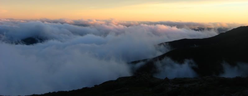
Next day saw me going over Anderson Mtn on more logging roads. The view from the top gave me the best sunset of the trail, something that has become a trend as I'm looking west all the time, and there are always marine clouds in the sky these days. The sea was getting closer and closer. On the west side of Anderson Mountain, I began seeing white blazes on trees for the first time. This made it so I didn't have to look at my map every 5 minutes to verify where I was. It's nice, but also lazy...but a nice change of pace.
I made it to the tiny tiny town of Alger...is it national news that this town had a random shooting of 5-6 people on the street? There was a candlelight vigil going on as I walked into down at dusk. The bar delivered a fantastic burger and some great beer....exactly what I had been dreaming of for the past 3 days. Exactly what had kept me going through some of the harder times on those damn loggging roads. When I was leaving, an awesome guy named River walked up and asked if I needed a place to crash. Of course I did. He led me back to his table where I met his 2 other friends, then we went back to their place. They lived at an old rock quarry .5 miles out of town. Totally off the grid. They have solar panels hooked up..and they lived out of individual tour busses, a van, and I got MY OWN YURT~!~!!! to sleep in. Great guys...fed me good oatmeal with fresh, locally made applesauce the next morning before taking off.
Yesterday I finally made it down to Samish Bay after a fantastic overlook, complete with Para-sailers taking off from it of Vancouver Island, the Olympic Mountains, the San Juan Islands, and lots of deep blue ocean. Gorgeous. There was pavement to be pounded, and pound it I did. Down here near Samish and Padilla Bays there are many many farms. It's been superb hiking in such flat land. Not because it's easy, but because there is such a contrast in this minimalistic ground/sky relationship that I"m not used to in the dynamic folds up high in the mountains. Some goats followed me. Dogs keep barking at me. Lots of stares toward the funny man in the skirt by passers-by in their cars.
Today the roadwalking finally got to me and I"m developing a shin splint and an achilles problem. I plan a short day tomorrow after picking up mail at the PO to set up a total beach walk the next day at low tide along the legendary Strait of Juan de Fuca...which I"m very excited about. Lots of hundred foot high bluffs that can't be hiked in front of during high tide. More bald eagles I"m sure. Anacortes is a decent town, but it's no Glacier. Maybe I'll post some pics tomorrow...I'd really like to, before heading out of town, climbing Mt Eerie, then sleeping on the coast. Tonight I"ll try to stealth downtown in the beautiful public park.
Subscribe to:
Post Comments (Atom)


1 comment:
I'm really glad to hear you enjoyed the logging section above Sedro Wooley and am also selfishly glad that you got a bit lost out there. I walked many-an-extra-mile out there taking wrong turns on unmarked and unmapped roads.
Post a Comment